

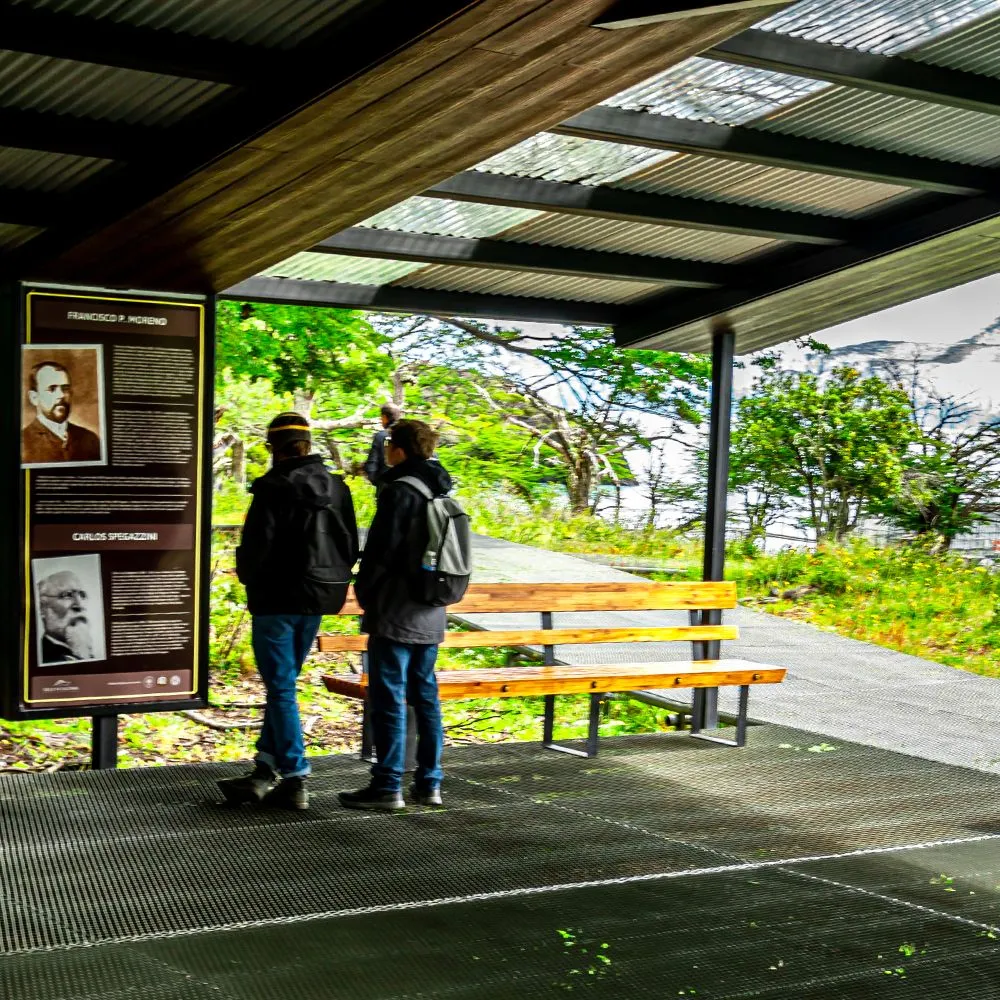
The Spegazzini Base trail connects the landing pier with the Spegazzini Refuge through the forest, and along the way there are interpretive stations dedicated to four themes: glaciology, history, fauna, and flora. It is accessible and can be explored during the All Glaciers Navigation disembarkation in Glacier Bay.
We envision it as an open-air classroom. We've been navigating these waters since 1980, and over the years, we've found that people enjoy glaciers more when they understand what they're looking at. This article tells you what you'll learn in each section and how to make the most of your trip.
The Spegazzini Base trail in a nutshell
Spegazzini Base is located in the northern sector of Lake Argentino, within Los Glaciares National Park, and is only accessible by water. Upon disembarking at the floating dock, an accessible trail begins, with gentle slopes, that winds through the forest to the Refuge. From the trail, walkways and viewpoints lead to the Spegazzini, Heim, and Peineta glaciers.
If you want the full picture of the landing, including the Refuge and the viewpoints, we cover it in a one-day report on Spegazzini Base . Here, we focus on what you learn while walking.
Glaciology: Understanding the ice in front of you
This is the topic that raises the most questions, because the Spegazzini Glacier, the tallest in the park, with walls up to 135 meters above the lake, is right there. These are the basic glaciological concepts worth taking away:
- How a glacier is born: The snow accumulates in the higher areas, compacts under the weight of the new layers, and transforms into dense ice.
- Why does it move? The ice flows downhill under its own weight, like a very slow river.
- Why does it look blue? Compact ice absorbs the red tones of light and reflects the blues.
- What are icebergs? fragments that break off from the front upon reaching the lake.
Looking at the landscape, you can also see the traces left by the ice: polished slopes, U-shaped valleys, and rock formations. To learn more, we recommend reading about moraines and the different types of glaciers.
History: who passed through these ice fields
Glacier Bay holds names that tell its story. These are some threads of that story worth keeping in mind as you walk:
- The first inhabitants. The Aonikenk, the southern Tehuelche, roamed the steppe and the shores of the lake long before the arrival of the explorers.
- The explorers and the names. The Spegazzini Glacier is named after Carlos Spegazzini, a botanist; the De Agostini Lookout is named after the priest and explorer Alberto De Agostini, who traveled through and photographed these ice fields.
- The National Park. Created in 1937 and declared a World Heritage Site by UNESCO in 1981.
- Navigations. In 1980 our concession began, the first privatization of lake services carried out by National Parks in Argentina.
The origin of each name is explained in the origin of the names of the glaciers.
Fauna: who lives between the forest and the ice
The forest surrounding the base is a refuge for animals that are rarely seen from the ship. It's helpful to know what to look for:
- Birds of the forest: The giant woodpecker, with its characteristic tapping on the lenga trunks, and small birds moving among the branches.
- Birds of the sky: The Andean condor, which sometimes soars over the slopes of the bay.
- Mammals: the red fox and other animals that use the forest as a corridor; also the huemul, the threatened Andean deer that inhabits the Park.
The golden rule: observe in silence, without feeding or approaching. The full picture is found in the wildlife of Los Glaciares National Park.
Flora: the forest at the edge of the glacier
The trail crosses Patagonian Andean forest, a very different environment from the steppe surrounding El Calafate. These are the main features you'll encounter:
| Species | What to look for on the trail |
|---|---|
| Lenga | The dominant tree in the forest; in autumn it turns red and yellow. |
| Ñire | Shorter and more twisted tree, common in edges and damp areas |
| Notro | Shrub with intense red flowers in spring and summer |
| Calafate | Thorny shrub with yellow flowers and dark blue berries |
| Lichens and mosses | They cover tree trunks and rocks; they indicate clean air and humidity. |
To identify the trees, see our article on the Patagonian Andean forest.
How to make the most of interpretive stations
- Go to the viewpoint, return via the stations. First look at the glacier; the seasons are enjoyed more when you already have questions.
- With kids, turn it into a game. Each person should choose a topic and tell the rest of the group about it at the Refuge.
- Use your ears. In silence you can hear the woodpecker, the wind in the lenga trees and, sometimes, the creaking of the glacier.
- Respect the disembarkation time. The crew indicates the time to return to the dock.
Explore the trail on the All Glaciers Navigation
The landing at Spegazzini Base is included in the All Glaciers Navigation Tour : a 7-hour sailing trip from Puerto Punta Bandera, from 8:30 AM to 16:00 PM (from April to August, from 9:30 AM to 17:00 PM), passing by the Upsala, Seco, Heim, Peineta, and Spegazzini glaciers. It departs daily from September to April and every other day from May to August. Check the departure schedule, availability, and current rates on the tour page.
FAQ
What themes do the interpretive stations at Spegazzini Base have?
Glaciology, history, fauna and flora. They are all found along the path that connects the pier with the Spegazzini Refuge.
Is the Spegazzini Base trail accessible?
Yes. It has level ramps and is complemented by a floating dock, accessible viewpoints, and adapted restrooms at the Refuge.
How do I get to the Spegazzini Base trail?
Only by water, with the All Glaciers Navigation, which disembarks at the Base after traveling through the glaciers of the North Arm and the Glaciers Bay.
Is the trail suitable for children?
Yes. It's short, accessible, and the interpretive stations are a great way for kids to understand the glacier while they walk.


